Miller Place Homes for Sale
Miller Place MLS Listings
According to the United States Census Bureau, the CDP has a total area of 7.2 square miles (19 km2).The area is hilly in some areas but has good grass and trees in most places because much of Miller Place was farm land before the population of Long Island grew.
Miller Place contains a small pond, a beach, and a small park that contains a baseball field. There are also many historical buildings in Miller Place. However, nearly all lands are heavily developed by either suburban housing communities or commercial locations.
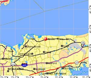
The hamlet borders the areas of Sound Beach, Mount Sinai, Rocky Point, Middle Island and Coram.
History
 Miller Place is a town that has been inhabited during five centuries. The region has gone through, and has been affected by, events including the French and Indian War and American Revolution. Throughout most of its history, Miller Place has been an agricultural based society. However, similarly to the changes in much of Long Island, the hamlet has transformed into a densely populated suburban area in recent decades.
While the original settler of Miller Place is unknown, the settling of the region is largely accredited to the original Miller family. In 1679, a man named John Thomas is known to have sold a local 30-acre (120,000 m2) plot to Andrew Miller, a cooper from either England or Scotland. Miller’s family expanded well into the 18th century and continually developed houses near the northern part of town.
The Millers were in time joined by members of such families as the Helmes, Robinsons, Burnetts, Hawkins, Woodhulls, and Thomases of Imperial
The first public school in the town was established in 1813. By 1818, 47 students attended classes. The original building was destroyed by a stove-fire in 1835, so a new one-room building was erected near the Ebenezer Miller house in 1837. The district moved to the Academy in 1897, a building that still stands as a small library along present-day North Country Road. In 1918 the old schoolhouse was torn down and in 1937 a new building was constructed across from the Miller Place Pond. In 1852, it was recorded that fifty children were being taught. In 1932, records show only twenty-one students enrolled at the school.
The old Miller homestead, one of the town’s most historic landmarks, was composed in three sections between the years 1720 and 1816
The hamlet became home to a station of the Long Island Railroad in 1895. This location was near the present day intersection of Sylvan and Echo Avenues. It transported people to stops at Port Jefferson, Wading River, and numerous other towns. Upon the station burning down in a 1902 fire, a new one was built the next year. However, this building was destroyed in 1930 by another fire and the eastern railroad lines were soon abandoned.
In the later 19th century, Miller Place became a popular summer resort location. A barn-like building known as the Harbor House was established and run by a Miss Clara Potter and quickly became a haven for many young girls. However the building was destroyed in a 1962 fire.
Many historical residencies still remain, mostly along what is now North Country Road. Also, many roads in the present town have been named after historical families. A number of historic building were included in the Miller Place Historic District, listed on the National Register of Historic Places in 1976. Separately listed is the Samuel Hopkins House.
Check out the Miller Place/Mt. Sinai Historical Society
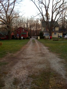
 The entrance to a local Christmas tree farm
There are 3,397 households out of which 46.7% have children under the age of 18 living with them, 74.0% are married couples living together, 6.8% have a female householder with no husband present, and 16.6% are non-families. 13.0% of all households are made up of individuals and 4.4% have someone living alone who is 65 years of age or older. The average household size is 3.10 and the average family size is 3.42.
The median income for a household in the CDP is $80,455, and the median income for a family is $87,656. Males have a median income of $58,887 versus $37,091 for females. The per capita income for the CDP is $27,895. 2.4% of the population and 1.0% of families are below the poverty line. Out of the total population, 2.6% of those under the age of 18 and 2.2% of those 65 and older are living below the poverty line.
With the constant development of new housing communities, the population of Miller Place is constantly on the rise.
Miller Place Listings
Miller Place is a hamlet and census-designated place (CDP) in Suffolk County, New York, United States, on the North Shore of Long Island. Miller Place has been inhabited since the 17th century and is named for the Miller family that included many of its initial settlers.
For most of its history, the community functioned as an agriculture-based society. Despite preserving much of its historic identity, changes in the 20th century have transitioned the hamlet into a desirable and densely populated suburban area. The population was 12,339 at the 2010 census.
In the decades following World War II, the population of Miller Place greatly expanded. The majority of beach cottages were repurposed as family homes and the town became home to many residents who commute daily to New York City. Commuters either use the Long Island Rail Road, with the nearest stations in Port Jefferson and Ronkonkoma, or drive along the extensive highway system that had been developed by Robert Moses. A number of residents also work at nearby Stony Brook University and Brookhaven National Laboratory.
The town post office since 1990
 The center of commerce within the hamlet has largely transitioned from the historic North Country Road to the modern Route 25A. Along North Country Road is McNulty’s, a family-owned ice cream parlor and a fixture of the hamlet, and a handful of inns and restaurants located in historic structures. Route 25A is of a more suburban character, with most businesses being corporate chains and located in strip malls. Also along Route 25A are multiple pizza parlors, a bagel store, a deli, and Crazy Beans, a local coffee shop and bar.
A 2012 plan by the Town of Brookhaven aims to comprehensively manage Route 25a between Mount Sinai and Wading River under planning strategies counter to those of car-oriented mid-century suburbia. For Miller Place, it intends to transition the section at Echo and Sylvan Avenues into a traditional downtown center with new mixed-use development and an expanded Sylvan Avenue Park that would compliment the current town post office and senior center. The plan additionally calls for the preservation of the DeLea Sod Farm, the largest agricultural parcel remaining on the Miller Place stretch of Route 25a.
Miller Place is located on Long Island’s North Shore and contains a 2-mile section of beach. It also hugs the east side of Mount Sinai Harbor, which it shares with neighboring Mount Sinai and Port Jefferson.
Beach on the Long Island Sound in Miller Place
Though the most popular beach in the area, Cedar Beach, is technically owned by adjacent Mount Sinai, Miller Place owns most of the land leading to this peninsular beach and thus has more residences in its vicinity.
The area is hilly in some patches, mostly near the beach, but generally has desirable grass and trees. Though the soil is suitable for agriculture, desire for housing has led most farms to be developed into suburban housing communities or commercial locations.
The hamlet borders the areas of Sound Beach, Mount Sinai, Rocky Point, Middle Island and Coram. Miller Place and Mount Sinai have historically been linked, with residents sharing such institutions as the Mount Sinai Congregational Church, located on the town border. The harborfront section of Port Jefferson, 5 miles to the west, serves as the primary commercial downtown for residents of both Miller Place and Mount Sinai.
Each September since 1981, the William Miller House has been the home of the Miller Place-Mount Sinai Country Fair. This annual festival includes house tours, arts and crafts, and antique merchants. A number of attendees dress in colonial-period costumes.
It is managed by the Miller Place-Mount Sinai Historical Society, an organization founded in 1979 that aims to preserve and promote the history and culture of the surrounding communities. The society acquired the William Miller homestead during its first year and, in addition to opening the grounds for the country fair, gives house tours by appointment throughout the summer months.
Schools
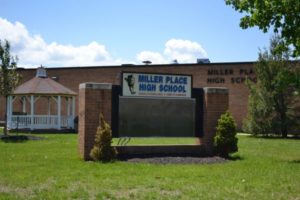
 The four schools of the Miller Place Union Free School District are scattered throughout the hamlet and serve both Miller Place and much of the hamlet of Sound Beach. These include the Andrew Muller Primary School (K-2), Laddie A. Decker Sound Beach School (3–5), North Country Road Middle School (6–8), and the Miller Place High School (9–12). The high school has been ranked the 78th in the nation for students taking AP classes.

